
Fund an Expedition
Help Us Choose the Next Adventure

RealRoads.tv is always planning the next long-distance journey — exploring America’s highways, backroads, small towns, and overlooked places — and now you can help shape where we go next.
Rather than a one-time competition, this page is where the RealRoads.tv community helps guide our future adventures. As new routes and ideas are added over time, you’ll always be able to support the trips you’d most like to see us film.
Right now, we’re considering several incredible road trip routes, each offering its own mix of scenic drives, hidden history, roadside culture, and unforgettable miles.
Your support helps make these productions possible — from fuel and lodging to filming, editing, and the countless hours spent documenting the journey. Contributions also help us understand which adventures the community is most excited to follow.
Choose the Next RealRoads.tv Adventure
Each featured trip below represents a possible future RealRoads.tv series. Support the journeys you want to see become reality and help shape where the road leads next.
How It Works:
Support the trips you’d most like to see us film. Contributions help fund future productions and show us which adventures resonate most with the community.
As trips are completed and new ideas emerge, this page will continue evolving with new adventures, new routes, and new stories waiting to be explored.
One or two day trips

There’s something different about the Arkansas River Valley. The mountains aren’t quite Ozarks, not quite Ouachitas — just their own thing entirely — rising unexpectedly above farmland, river bottoms, old highway towns, and some of the oldest roads in the state.
This journey winds through western and central Arkansas along a route shaped by rivers, ridgelines, and generations of travelers. It begins high atop Petit Jean Mountain, where sweeping overlooks stretch across the Arkansas River Valley and the first curves of the journey descend through thick forest toward Arkansas Highway 7. From there, the route turns west along Highway 22, following one of the great east-west corridors across the valley toward the quiet backroads of Logan County and the historic Military Road, where traces of Arkansas frontier history still linger beneath quiet trees and rolling farmland. From there, the road drifts through places like Paris and Magazine, where broad valley views meet the shadow of Mount Magazine, the state’s highest peak.
Further west, Fort Smith carries the unmistakable weight of frontier history — a crossroads of soldiers, outlaws, river trade, and westward expansion. Eastward, the landscape softens again around Ozark, Piney Bay, and Lake Dardanelle, where the Arkansas River slows into wide water and long sunsets.
The route circles through Holla Bend’s rich farmland and wildlife refuge country before climbing toward the Petit Jean and Mount Nebo areas, where overlooks reveal just how vast the River Valley really is. From up high, the highways below seem small — threading together tiny towns, forgotten roads, lakes, farms, forests, and mountains into one connected landscape.
It’s a drive that feels deeply Arkansas: scenic without trying too hard, historic without needing signs everywhere, and full of the kind of roads that reward slowing down long enough to notice them.
Recent Supporters
No supporters yet.
Updates
No updates available.
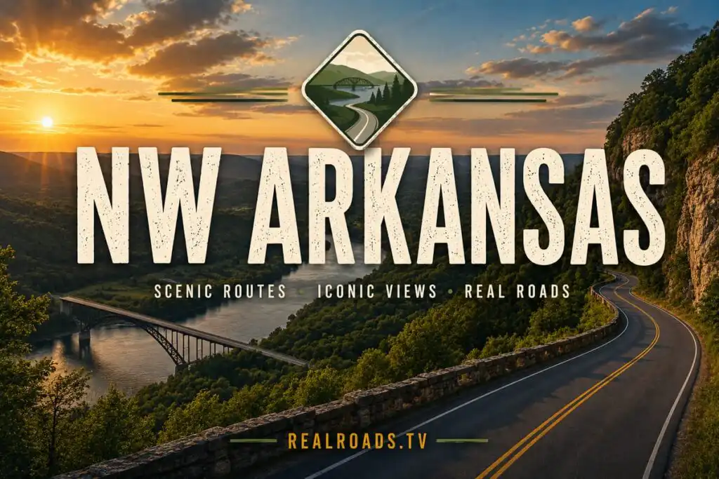
Northwest Arkansas has become one of the fastest-growing regions in America, but beyond the new developments, corporate campuses, and expanding highways lies a network of roads that tell the real story of the region. From quiet farming communities and historic town squares to scenic ridgelines, lake country, and winding roads that trace the edge of the Ozarks, this journey explores the highways and backroads that connect it all.
Beginning in Fayetteville, the route follows a collection of Northwest Arkansas's most interesting and important roads. Arkansas Highway 45 winds through the countryside east of the city before returning toward the urban core, while Arkansas Highway 265, one of the region's historic alignments, passes through communities that predate the area's explosive growth. Along the way, roads like Arkansas Highways 112 and 264 reveal a different side of Northwest Arkansas — one shaped by farmland, small towns, and the steady expansion of the region's transportation network.
The journey then turns west toward Oklahoma, following U.S. Route 62 through Prairie Grove and Lincoln before crossing the state line into Westville. Returning eastbound, the route captures one of the region's most important east-west corridors, linking rural communities with the cities and businesses that now define modern Northwest Arkansas.
From there, the expedition explores the scenic roads that surround Beaver Lake and Pea Ridge. Arkansas Highway 94 and its southern counterpart wind through rolling hills, lakeside communities, and historic landscapes, while Arkansas Highways 289 and 340 showcase the beauty and character of the region's lake country. Further west, Arkansas Highway 59 climbs north from Siloam Springs toward Missouri, connecting Arkansas with the small towns and scenic highways of the Ozark borderlands.
Crossing briefly into Missouri, the route follows Missouri Route 90 through Noel and the surrounding countryside before returning south. Along the way, the trip captures the roads, scenery, and small communities that often get overlooked by travelers focused solely on Interstate 49.
The expedition also highlights the future of transportation in Northwest Arkansas, including the completed Arkansas Highway 612 corridor and the new airport connector serving Northwest Arkansas National Airport. Together, these roads represent both the history and future of a region that continues to grow while remaining deeply connected to its Ozark roots.
Designed as a long-weekend adventure, this journey blends scenic drives, growing communities, historic routes, lake country, and regional highways into a comprehensive look at one of America's most dynamic regions. It's a road trip that goes beyond the headlines and growth statistics to explore the roads that make Northwest Arkansas what it is today.
Recent Supporters
No supporters yet.
Updates
No updates available.
Regional Adventures

Southern Missouri is a region most travelers pass through without ever really seeing. Beyond the interstates and tourist towns lies a landscape of Ozark ridges, winding highways, river cities, forests, farmland, and some of the most underrated driving roads in the Midwest.
This journey begins in St. Louis, where the Mississippi River, massive freeway interchanges, and the eastern terminus of Interstate 44 set the stage for a westbound run across Missouri’s historic Route 66 corridor. From the urban skyline and rolling hills around St. Louis, the route follows Interstate 44 southwest through the heart of the Ozarks toward Springfield — tracing one of America’s classic travel corridors through forests, ridgelines, and small-town Missouri.
From Springfield, the trip shifts southeast onto U.S. Route 60, crossing deep into southern Missouri through long stretches of farmland, wooded hills, and regional highway towns before reaching the forests and river country around Poplar Bluff and Cape Girardeau. Along the way, the landscape gradually transforms from Ozark highlands into the edge of the Mississippi Delta, revealing a side of Missouri many travelers never experience.
The route then turns west again along U.S. Route 160, one of the defining highways of southern Missouri, weaving through mountain towns, forest valleys, and the rugged terrain of the Ozarks. Scenic stretches of Missouri Highways 125, 76, and 14 add winding ridge roads, quiet countryside, and some of the region’s best driving scenery before reconnecting with U.S. Route 63 and heading north once more.
Designed as a long-weekend-scale adventure, this trip blends major interstates, historic U.S. highways, scenic Ozark backroads, river cities, and classic Americana into one connected journey across southern Missouri. It’s a drive built around the roads themselves — the changing landscapes, the small towns, the overlooked corridors, and the feeling of crossing an entire region one highway at a time.
Recent Supporters
No supporters yet.
Updates
No updates available.
Epic Trips

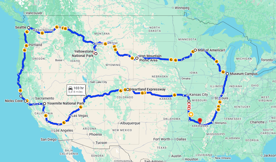
The Pacific Northwest Mega-Loop is the largest multi-state filming project RealRoads.tv has ever attempted. Beginning in Sikeston, Missouri and spanning more than 5,000 miles across America’s most dramatic landscapes, this expedition will capture brand-new POV drives, National Parks, coastal highways, and iconic Western corridors in full cinematic detail.
This trip includes Chicago, the Black Hills, Yellowstone, Grand Teton, the Columbia River Gorge, Seattle, the Oregon Coast, northern California, Las Vegas, the Rockies, and a final extended stop in Kansas City. Every mile will be filmed in 4K for the RealRoads.tv and OpenRoadArchive.com communities.
Your contribution helps offset fuel, lodging, tolls, park entry fees, equipment costs, and daily production needs. Every donation directly funds the footage you’ll see in future videos — and supporters will also unlock special behind-the-scenes updates during the trip.
Help make the largest RealRoads.tv project yet a reality.
Recent Supporters
No supporters yet.
Updates
No updates available.

Texas is too large to understand through a single highway. This journey is built around the idea that the state only truly reveals itself when you experience its changing regions mile by mile — from desert mountains and border crossings to Gulf beaches, Hill Country backroads, refinery skylines, and endless interstate corridors stretching toward the horizon.
Beginning in Arkansas and pushing deep into Texas, the route follows many of the state’s most important highways and urban corridors while exploring the places that define modern Texas. The journey heads west through oil country and the wide-open landscapes of West Texas before reaching El Paso, where mountains rise above the interstate and the border becomes part of everyday life.
From there, the drive follows Interstate 10 across vast desert basins and rugged terrain before turning toward the Hill Country, where winding roads, limestone hills, rivers, and small towns offer a slower pace and a completely different side of the state. Austin and San Antonio bring towering freeway systems, historic districts, and the unmistakable contrast between old and new Texas.
Further south, the route pushes toward Corpus Christi and the Gulf Coast, where beaches, shipping channels, coastal bridges, and sea air provide a pause from the long interstate miles. The journey then continues through Houston’s sprawling freeway network and industrial skyline before crossing into the refinery corridors of Beaumont and the pine forests of East Texas near Tyler and Longview.
More than a simple road trip, this is a full-scale journey across the many identities of Texas — a drive through border towns, freight corridors, coastlines, massive cities, quiet stretches of highway, and landscapes that seem to change completely every few hundred miles.
Over ten days, the trip becomes both an expedition and a living archive of the roads, regions, and atmosphere that make Texas unlike anywhere else in America.
Recent Supporters
No supporters yet.
Updates
No updates available.

The Florida / Florida Keys / Low Country Trip is a coastal-to-coastal filming project capturing some of the most iconic shoreline highways in the United States. This expedition will feature Gulf Coast drives, Everglades crossings, the legendary Overseas Highway to Key West, the Atlantic coastline, and the historic Low Country of Georgia and South Carolina.
The region blends tropical scenery, barrier islands, historic coastal towns, and unique engineering landmarks — all of which translate into stunning road footage. This trip also includes National Park visits, sunrise/sunset coastal filming, and careful routing around high-congestion areas for the best on-camera results.
Your donation directly supports route coverage, lodging near safe and affordable areas, fuel across long coastal corridors, and the extensive production work involved in filming narrow historic districts and waterfront highways.
Help make this southern coastal series a reality for RealRoads.tv.
Recent Supporters
No supporters yet.
Updates
No updates available.

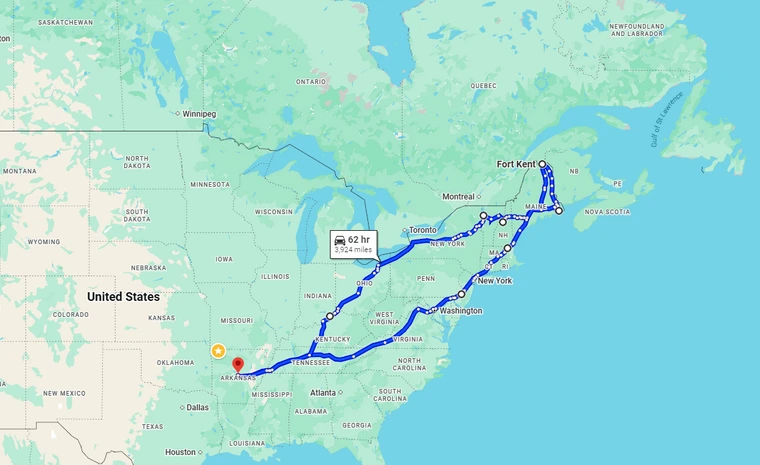
The New England & Northern Coast Trip brings RealRoads.tv to one of the most scenic, historic, and culturally rich regions in the country. From Boston’s urban core to the rocky Maine coastline, from Vermont’s mountain corridors to the coastal routes of New Hampshire and Rhode Island, this trip will capture an entirely new set of drives that the channel has never documented before.
This expedition focuses on major coastal highways, historic byways, lighthouse routes, fall-colored mountain passes, and the century-old transportation corridors that shaped the Northeast. Filming days will cover dense metros, narrow coastal towns, and high-scenic overlooks — the kind of coverage that makes New England one of America’s most requested series.
Your support helps make the full itinerary possible, covering the core needs of multi-day production: fuel, lodging, meals, toll roads, equipment care, and time-intensive urban filming.
Help bring the first full New England collection to RealRoads.tv.
Recent Supporters
No supporters yet.
Updates
No updates available.