
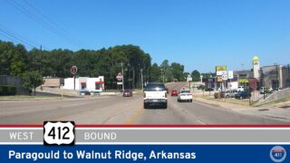
Take a drive across the changing landscape of northeast Arkansas as we follow U.S. Route 412 east from Walnut Ridge to Paragould, traveling approximately 30 miles from Interstate 57 to U.S. Route 412 Business on the east side of Paragould. What initially looks like a straightforward trip across flat Delta farmland turns out to be a surprisingly varied piece of highway. Along the way, we leave the broad agricultural lowlands surrounding Walnut Ridge, pass the small community of Light on a newer four-lane alignment, climb onto the distinctive uplands of Crowley’s Ridge, and finally swing around Paragould on the city’s modern bypass. It is a relatively short journey, but one that neatly illustrates how geography, agriculture, and highway construction have shaped transportation across northeast Arkansas.
We begin on the eastern side of Walnut Ridge, where US-412 separates from Interstate 57 and U.S. Route 67 at the present northern end of I-57. Interstate 57’s Arkansas designation was extended north from North Little Rock to Walnut Ridge in 2024, making this interchange an increasingly important point on the regional highway network. Beyond the junction, US-412 heads east into the low country of Lawrence County, and development falls away quickly. Walnut Ridge itself sits in Arkansas’s Upper Delta, and the landscape east of town reflects that setting: broad fields, long sightlines, drainage channels, scattered farmsteads, and strips of trees following waterways and property boundaries. The road here is part of a transportation corridor that has long connected the communities of northern Arkansas with the agricultural country approaching the Mississippi River valley.

Continuing east, we cross the Cache River and enter Greene County, staying in a landscape dominated by agriculture. This is part of the Mississippi Alluvial Plain, an enormous lowland region created and repeatedly reworked by the river systems draining toward the Mississippi. The terrain is notably different from the Ozark country farther west along US-412: elevation changes are minimal, fields can extend almost uninterrupted to the horizon, and the highway often seems to run in long, deliberate lines across the countryside. Agriculture remains the visual theme, with cultivated fields, farm equipment, grain facilities, drainage infrastructure, and occasional clusters of homes marking the otherwise open landscape. U.S. Geological Survey descriptions of the region place this area within the broad alluvial plain west of Crowley’s Ridge, which rises conspicuously above the surrounding lowlands farther east.
Near Light, the history of the highway itself becomes visible in the alignment. The community lies about fourteen and a half miles west of Paragould at Arkansas Highway 228, but modern US-412 no longer runs directly through it. In November 2020, traffic was shifted onto a new bypass south of Light as part of the project to widen US-412, leaving the older roadway to serve the community locally. The Arkansas Department of Transportation’s project notice documents that change. Today we remain on the newer mainline, passing the junction with Highway 228 before continuing toward Arkansas Highway 141. The setting remains strongly rural here, but the road’s larger footprint and more modern design give this stretch a distinctly different character from the older two-lane highway that once carried US-412 through Light.
East of Light, the drive begins to change more noticeably. After the junction with Highway 141, US-412 reaches Arkansas Highway 168, which provides access toward Crowley’s Ridge State Park, and the ruler-flat Delta landscape begins giving way to the higher ground associated with Crowley’s Ridge. This narrow geological formation extends from southern Missouri deep into eastern Arkansas and rises roughly 100 to 250 feet above the surrounding alluvial plain. Rather than remaining entirely in the Delta, as the original description suggested, this drive actually gives us a compact demonstration of the contrast between the two regions. The highway approaches and crosses the ridge west of Paragould, where wooded slopes, rolling ground, and a more enclosed landscape begin interrupting the broad agricultural vistas behind us. The Encyclopedia of Arkansas overview of Crowley’s Ridge explains how this unusual landform stands apart from the flat country surrounding it.

Approaching Paragould, rural land gradually gives way to the transportation and commercial landscape of one of northeast Arkansas’s principal regional centers. Rather than following the older US-412 alignment directly through town, we stay on the mainline bypass, meeting the western end of US-412 Business before curving around the southern side of the city. The bypass carries us past connecting roads serving residential neighborhoods, industry, and the US-49 corridor while keeping through traffic away from the older street network. Paragould’s growth has always been closely tied to transportation. The city was created where two competing railroads crossed in 1882, and even its unusual name combines those of railroad executives J. W. Paramore and Jay Gould. Timber and rail transportation fueled its early development before agriculture and manufacturing became increasingly important to the local economy. The City of Paragould’s history page provides more background on that railroad heritage.
Our drive ends at the eastern junction with U.S. Route 412 Business, near Arkansas Highway 135, where the business route rejoins the bypass after passing through Paragould. From here, US-412 continues east across the lowlands toward the St. Francis River, the Missouri state line, and eventually Kennett in the Missouri Bootheel. Looking back over the drive from Walnut Ridge, the most memorable feature is not a single landmark but the transition between landscapes. We begin amid the immense horizontal scale of northeast Arkansas farmland, follow a modernized highway past Light, rise onto the wooded remnant of Crowley’s Ridge, and finish amid the expanding road network of Paragould. In barely 25 miles, Walnut Ridge to Paragould gives us a concise cross-section of northeast Arkansas—a place where the Delta, the ridge, farming communities, rail history, and modern highway engineering all meet along U.S. Route 412.
🎵 Music: Track List
Music featured in this video may be available from The Open Road Collective:
🗺️ Route Map




0 Comments