
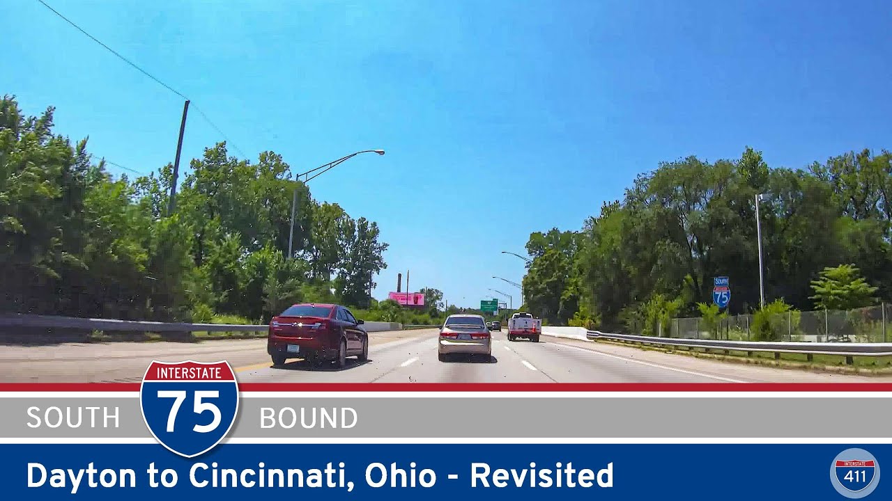
Take a drive through the heart of southwestern Ohio as we follow Interstate 75 north from Covington, Kentucky, through Cincinnati and into Dayton, Ohio. This 57-mile journey connects two of the state’s largest metropolitan areas, carrying us across the Ohio River, through historic industrial communities, and along a busy transportation corridor that has helped shape the region for generations. From Cincinnati’s dramatic riverfront skyline to the manufacturing towns of the Miami Valley, the drive offers a continuous look at the changing landscape of one of the Midwest’s most important north–south highways.
We begin in Covington, Kentucky, traveling north on the combined Interstate 71/75 corridor as the highway descends toward the Ohio River. Ahead, the skyline of downtown Cincinnati rises above the waterfront, creating one of the more memorable approaches to the city. We cross the river on the double-decked Brent Spence Bridge, a major transportation link connecting Kentucky and Ohio since 1963. Carrying both I-71 and I-75, the bridge has long served as a critical connection for passenger vehicles and commercial freight moving through the eastern United States. Its importance has also made it the focus of the Brent Spence Bridge Corridor Project, an extensive effort to improve capacity, safety, and regional connectivity. As we enter Ohio, the highway carries us directly into the urban landscape of Cincinnati.
Just beyond the river, Interstate 71 separates from Interstate 75, heading northeast while we continue north along the western edge of downtown. The surrounding landscape is distinctly urban, with elevated ramps, railroad infrastructure, warehouses, commercial buildings, and established neighborhoods occupying the narrow valley between the city’s hillsides. Near the highway stands Cincinnati’s historic Union Terminal, an Art Deco railroad station that now houses the Cincinnati Museum Center. Opened in 1933, the terminal recalls an earlier era when passenger railroads played a central role in the city’s transportation network. Continuing north, we reach the interchange with Interstate 74, which provides a westward connection toward Indianapolis. Here, the combination of interstate traffic, local commuters, and commercial vehicles reinforces Cincinnati’s role as a major regional crossroads.
Beyond Interstate 74, we continue through Cincinnati’s northern neighborhoods, where residential districts, industrial properties, and commercial development occupy the land surrounding the highway. The terrain remains somewhat rolling, reflecting the hills and stream valleys of the Ohio River region, although much of the immediate landscape has been reshaped by decades of urban development. We pass the connection with the Ronald Reagan Cross County Highway, Ohio State Route 126, an east–west expressway serving Cincinnati’s northern suburbs. Farther north, Interstate 75 approaches the large interchange with Interstate 275, the beltway encircling Greater Cincinnati and parts of northern Kentucky and southeastern Indiana. As we pass beneath its connecting ramps, the landscape begins transitioning away from the older urban core and toward the expanding suburban communities to the north.
North of Interstate 275, we enter a corridor characterized by office parks, shopping centers, distribution facilities, and residential development. The highway passes through the West Chester area, where major commercial interchanges at Union Centre Boulevard and Tylersville Road serve one of southwestern Ohio’s busiest suburban business districts. Farther north, Ohio State Route 129 provides a connection west toward Hamilton, while the highway continues toward Monroe. Although wooded areas and occasional open fields interrupt the development, much of this stretch reflects the continuing growth of the Cincinnati metropolitan region. What was once a more distinctly rural passage between two separate cities has increasingly become a continuous corridor of suburban communities and employment centers.

As we approach Monroe and Middletown, the surrounding landscape begins to reveal the region’s industrial heritage. Middletown developed into a major manufacturing center during the nineteenth and twentieth centuries, particularly through its iron and steel industries. The city’s industrial tradition remains an important part of the broader Miami Valley economy, even as manufacturing has evolved and distribution and service industries have expanded. Interstate 75 passes east of Middletown’s historic downtown, connecting with Ohio State Route 63 near Monroe and Ohio State Route 122 farther north. Between these interchanges, the scenery includes wooded areas, commercial properties, scattered farmland, and neighborhoods that extend outward from the region’s established communities.
Continuing north, we pass near Franklin and Springboro, where Ohio State Route 73 connects the interstate with communities on both sides of the highway. This stretch marks another transition as the Cincinnati metropolitan area gradually gives way to the southern suburbs of Dayton. Residential subdivisions, business parks, and distribution centers become increasingly prominent, particularly around the Austin Boulevard interchange. The developing suburban landscape reflects the growth of the Cincinnati–Dayton corridor, where expanding communities have helped blur what was once a more obvious separation between the two metropolitan areas. We soon reach Interstate 675, which branches eastward around Dayton, providing an alternate route toward Centerville, Beavercreek, and the eastern Miami Valley.
Remaining on Interstate 75, we continue north through the Miamisburg and West Carrollton area before approaching Moraine and the southern edge of Dayton. The highway again takes on a more urban character, passing established neighborhoods, industrial properties, and commercial districts. This part of the Miami Valley has a long manufacturing history, shaped by automotive production, machinery, and the transportation networks that supported regional industry. As we move closer to downtown Dayton, the Great Miami River becomes an increasingly important feature of the landscape. The river and its tributaries have influenced the development of communities throughout the valley, providing both transportation opportunities and significant flood-management challenges. Dayton’s experience with the catastrophic flood of 1913 ultimately led to the creation of one of the nation’s notable regional flood-control systems.
Approaching downtown Dayton, Interstate 75 meets U.S. Route 35, an important east–west connection serving the city and surrounding communities. The highway follows the western side of downtown, where office buildings, bridges, and older industrial districts create a more concentrated urban setting. We cross the Great Miami River as the interstate curves through the city, passing near the riverfront and the northern edge of downtown. The nearby Mad River joins the Great Miami in this part of Dayton, reinforcing the city’s historic relationship with its waterways. Farther north, the highway reaches the interchange with Ohio State Route 4, which branches northeast toward Riverside and the communities surrounding Wright-Patterson Air Force Base. Our journey concludes at this interchange, just beyond downtown Dayton.

Throughout this drive, Interstate 75 tells the story of a region connected by transportation, manufacturing, and suburban growth. We have traveled from the steep river valley surrounding Cincinnati into the broader landscape of the Miami Valley, passing through communities whose histories are closely tied to railroads, factories, and interstate commerce. The transition is gradual rather than abrupt, with one metropolitan area increasingly blending into the next along a highway that serves both local communities and long-distance travelers. From the Brent Spence Bridge to Dayton’s river crossings, this 57-mile northbound journey captures the evolving character of southwestern Ohio through the uninterrupted perspective of the open road.
🎵 Music: Track List
Music featured in this video may be available from The Open Road Collective:



0 Comments