Drive Arkansas Highway 319 west from Ward to Vilonia through the heart of central Arkansas farmland. This 15-mile route crosses rural White and Faulkner counties, showcasing open fields, growing communities, and the resilient spirit of Vilonia.


State highways form the backbone of regional travel across the United States, offering essential connections between cities, rural communities, and major national routes. Managed by individual state departments of transportation, these highways vary widely in scale—from narrow rural byways to multi-lane expressways rivaling interstates in traffic and speed. While numbering systems and signage conventions differ from state to state, each network plays a critical role in local mobility and economic development.
Unlike the federally designated Interstate and U.S. Highway systems, state highways are developed and maintained at the state level, giving them a unique character and flexibility. Some follow historic paths and scenic corridors, while others serve as modern commuter routes or urban spurs. Many are vital links to state parks, natural attractions, and lesser-known destinations that don't fall within the national systems.
On this site, we highlight a growing collection of notable state highways, organized by region and state. Whether you're tracing a scenic loop through the mountains, navigating a fast-moving corridor through a metro area, or exploring forgotten rural routes, our guides offer detailed overviews, and video journeys to help you plan your next adventure.
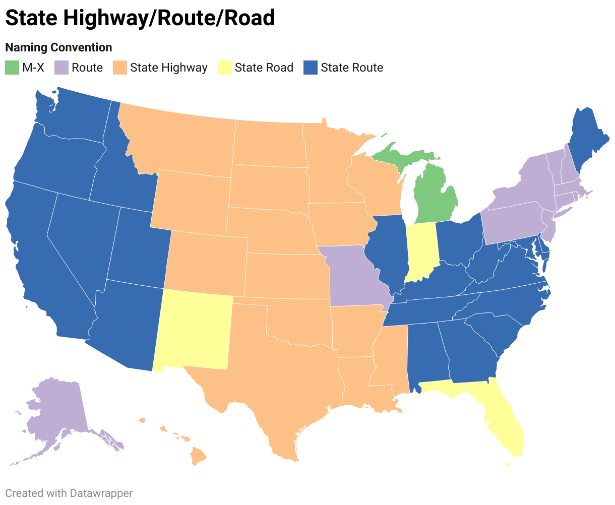
State Departments of Transportation use different terminology for their designated road systems, with some states using "state highway," others "state road," and still others "state route." These distinctions, though seemingly minor, often reflect historical and legislative traditions within each state. The choice of a particular term can be tied to the legal language used when the road network was first established or expanded. For example, a state might have initially defined its network as a "system of highways" for commerce and travel, while another may have focused on creating a "system of roads" for local and inter-city connections. The term "state route" is often a more modern designation that emphasizes a specific numbered path for navigation rather than the physical characteristics or purpose of the road itself. While the exact reasoning for each state's choice is complex and rooted in its unique history, the map on the right provides a visual guide to which term is used where.
Drive Arkansas Highway 319 west from Ward to Vilonia through the heart of central Arkansas farmland. This 15-mile route crosses rural White and Faulkner counties, showcasing open fields, growing communities, and the resilient spirit of Vilonia.

Drive Arkansas Highway 367 from Beebe to Ward, Arkansas, following a historic frontage-style corridor alongside Interstate 57 through White County farmland, growing suburbs, and small-town central Arkansas scenery.

Drive Arkansas Highway 31 south from Floyd to Beebe, Arkansas, on a quiet 10-mile rural route through White County farmland, small communities, and Delta-edge countryside.

Drive Tennessee Route 690 around Union City, a 10.6-mile bypass connecting US-51 and forming part of the future Interstate 69 corridor. Experience flat farmland, open landscapes, and a modern roadway designed for tomorrow’s traffic.

Drive Oklahoma Route 66 from Oklahoma City to El Reno in this 28-mile journey across one of the state’s most intact Mother Road segments, featuring Yukon, open prairie landscapes, and historic roadside character.

Drive 8 miles along Arkansas Highway 229 from Traskwood to Haskell as pine woods give way to neighborhoods and a short US-67 concurrency guides you to I-30. A clear, chronological tour of road character, local context, and key junctions on AR-229.

Cruise 10 miles north on Arkansas Highway 229 from Poyen to Traskwood, passing pine plantations, hay fields, and quiet rural communities along a classic two-lane highway in south-central Arkansas.

A calm 11-mile drive on Arkansas Highway 229 from Leola to Poyen through timber country and small farms, ending at US-270. Gentle curves, pine stands, and small-town rhythms in the Ouachita foothills.
![Arkansas Highway 46: Sheridan to Leola [Revisited]](https://media.openroadarchive.com/file/ora-media/uploads/2025/10/kyk61mgzg1umaxresdefault.jpg)
A calm, first-person drive along Arkansas Highway 46 from Sheridan to Leola—through pine plantations and Saline River bottomlands—with a worthwhile side trip to Jenkins Ferry Battleground State Park. Route details, scenery notes, local context, and a map.
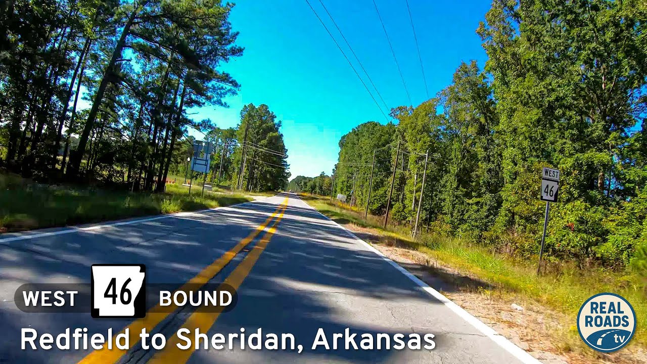
A first-person drive on Arkansas Highway 46 from Redfield to Sheridan: 16 miles of Piney Woods, gentle curves, rural homesteads, and a smooth two-lane connector between AR 365/I-530 and US 270—with local history and small-town context along the way.

A 31-mile Ozark-foothills drive on AR-25 from Heber Springs to Greenbrier—past hay fields, hardwood ridges, and small-town main streets—ending at US-65 with valley views.

Cruise Arkansas Highway 16 from Greers Ferry to Heber Springs—a 22-mile lake-to-town drive of wooded ridgelines, fleeting Greers Ferry Lake views, and a welcoming finish near the Little Red River. Highlights include Devils Fork Recreation Area, Heber Springs’ trout-rich tailwater, and a smooth two-lane rhythm ideal for an unhurried pace.